UN
9 Gresford Way
£ 102,000
Description
We don't have a Description for this property.
- Bedrooms
- 3
- Bathrooms
- 0
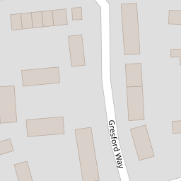

Leaflet © OpenStreetMap contributors
The heatmap indicates the level of crime in the area. The color of the heatmap indicates the crime severity and recency.
Metrics Year-on-Year
- Average area value
- 363,275.00 £Increased by 0.98 %
- Average area rental value
- 922.00 £/moDecreased by 1.28 %
- Est rental Yield
- 3.05 %Decreased by 2.24 %
- Crime Rate
- 7.00 %Unchanged by 0.00 %
from 359,732.00 £
from 934.00 £/mo
from 3.12 %
from 7.00 %
Nearby Schools
| Name | Type | Ofsted | Distance |
|---|---|---|---|
| Wat'S Dyke C.P. School | Welsh Establishment | 1.19 KM | |
| Rhosddu Primary School | Welsh Establishment | 1.77 KM | |
| Alexandra C.P. School | Welsh Establishment | 1.94 KM | |
| Ysgol Rhosnesni | Welsh Establishment | 2.01 KM | |
| Ysgol Plas Coch | Welsh Establishment | 2.24 KM |
Images
Nearby Streets
| Name | Average Price | Average Sqft | Distance |
|---|---|---|---|
| Newbrigg Road | £ 0 | 0 | 0.00 KM |
| Heol Llanddewi | £ 320,000 | 0 | 0.00 KM |
| Chester Road | £ 333,333 | 0 | 0.00 KM |
| Sussex Gardens | £ 265,000 | 0 | 0.00 KM |
| Pandy Lane | £ 0 | 0 | 0.00 KM |
Nearby Transport
| Name | NLC | TLC | Distance |
|---|---|---|---|
| Wrexham General | 4487 | WRX | 2.57 KM |
| Wrexham Central | 4486 | WXC | 2.73 KM |
| Gwersyllt | 4300 | GWE | 3.44 KM |
| Cefn-Y-Bedd | 2425 | CYB | 5.96 KM |
| Caergwrle | 2536 | CGW | 6.75 KM |
Nearby Listings
| Address | Price | Type | Score | Distance |
|---|---|---|---|---|
| Gresford Way, Wrexham | £ 219,950 | BUY | Unknown | 0.08 KM |
| Gladwyn Road, Wrexham | £ 220,000 | BUY | 6 / 10 | 0.13 KM |
| Frances Avenue, Wrexham | £ 280,000 | BUY | 7 / 10 | 0.21 KM |
| 28 Burton Drive, Wrexham, LL12 8BG | £ 160,000 | BUY | 6 / 10 | 0.21 KM |
| Ffordd Lerry, Wrexham | £ 270,000 | BUY | 6 / 10 | 0.22 KM |
Nearby Properties
| Address | Price | Distance |
|---|---|---|
| 31 Gresford Way | £ 133,000 | 0.00 KM |
| 11 Gresford Way | £ 144,500 | 0.00 KM |
| 9 Gresford Way | £ 102,000 | 0.00 KM |
| 32 Gresford Way | £ 150,000 | 0.02 KM |
| 26 Gresford Way | £ 130,000 | 0.02 KM |